

Beinn Mhartainn [Ben Mhartainn]
Good walks are even better shared.
Overview
Beinn Mhartainn [Ben Mhartainn]
Introduction
Beinn Mhartainn, a stunning Munro in the heart of the Scottish Highlands, boasts an elevation of 811 meters. This mountain is an absolute gem for hikers, offering breathtaking views and a sense of accomplishment once you reach the summit.
Geology
The geological features of Beinn Mhartainn showcase a fascinating history of ancient metamorphism. You’ll find Schists and Gneisses, crafted over millions of years, staring down at you like an old Scottish grouch who has seen it all.
Routes
The most popular route, the Ben Mhartainn Circuit, spans approximately 10.5 km and usually takes around 4.5 hours to complete. It’s a moderate hike, perfect for those who enjoy a challenge but aren’t ready to fight for their lives in the Highlands.
Terrain and Hazards
The mountain's terrain is a mixed bag of rocky outcrops, grassy patches, and a few cheeky bogs looking to trip you up. Watch your step! Also, keep an eye on the weather; it has a reputation for changing as quickly as a squirrel on espresso.
Views
From the summit, the panoramic views are nothing short of spectacular. You can spot the islands of Jura and Islay, as well as other peaks in the Paps range. The best time to enjoy these sights is late spring to early autumn when the weather is more forgiving, and the flowers are in bloom.
Access
Getting to Beinn Mhartainn is a doddle. Park at the small area near Ardlussa, and you’ll find the trailhead ready to whisk you away into the wild. If you’re relying on public transport, Lochgilphead is your best bet, located a simple bus ride away.
Facilities
While Beinn Mhartainn itself is a bit sparse on amenities, the nearest town, Lochgilphead, offers various facilities such as cafes to fuel up on caffeine before your hike and public toilets.
History
The mountain’s name, which means 'Mountain of the Martyrs', speaks to the rich tapestry of Scottish history and Gaelic culture. It's not just a pretty face; Beinn Mhartainn has tales to tell.
Conclusion
In summary, Beinn Mhartainn is a superb mountain for all levels of hikers seeking adventure and stunning vistas. Just remember to pack your wellies, a sense of humour, and perhaps a wee dram for the summit celebration!
Happy hiking!
Explore routes near Beinn Mhartainn [Ben Mhartainn]
Public walks starting within 80 km of this hill. Nearby does not mean a route reaches the summit; check its map and access before setting out.
Route planning notes
These notes describe possible approaches, not verified navigable routes or permission to cross land. Check current paths, local access rules and conditions before setting out.
Ben Mhartainn Circuit
A popular circular route that offers stunning views throughout the hike, taking you around the scenic glens and coire.
Make a day of it, together
Find someone to share the walk with, or organise a day out along a route you like.
Photo Gallery
View all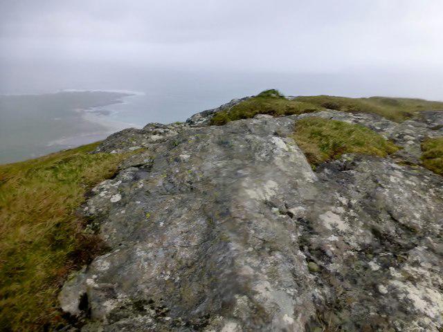 Photo could not load
NF6602 : Beinn Mhartainn
Rude Health
Hill facts and local notes
Classifications
Elevation
244m
801 ft
Prominence
110m
Coordinates
56.9890, -7.4946
NF664020
OS Map
31
Explorer: 452N
At the Summit
The summit features a well-built stone cairn, ideal for a triumphant pose or two for your Instagram followers, alongside breathtaking views of the surrounding peaks.
Terrain & Geology
Beinn Mhartainn is primarily composed of ancient metamorphic rocks, with prominent Schists and Gneisses that tell tales of tectonic activity from a time when the gods were still figuring out land formation. The rugged terrain showcases glacial activity creating sharp ridges and magnificent cliffs.
Views & Scenery
Clear views of the islands of Jura and Islay, as well as the rugged mountains of the nearby Paps.
History & Heritage
Name Origin
The name Beinn Mhartainn translates to 'Mountain of the Martyrs,' possibly hinting at the area's rich and tumultuous history.
Historical Significance
The mountain has cultural significance to the local Gaelic-speaking communities and is often featured in folklore.
Getting There & Facilities
Check current local access restrictions, parking rules and transport timetables before travelling. These notes do not confirm public access to the summit.
Parking
There is a small parking area near the village of Ardlussa which provides access to the start of the Ben Mhartainn Circuit.
Public Transport
The nearest public transport is from the town of Lochgilphead, where you can catch a bus to Ardlussa, followed by a short walk to the start of the hike.
Nearby Facilities
The nearest facilities are located in Lochgilphead, where you find cafes, shops, and public toilets.
Safety Information
Known Hazards
- Steep ascents can be challenging, particularly in wet conditions; be mindful of loose stones and potential for sudden weather changes.
General Safety Tips
- Check weather conditions before setting out
- Carry appropriate clothing and equipment
- Let someone know your planned route
- Take a map, compass, and GPS device
- Carry emergency supplies: food, water, first aid kit, torch
Hills
Some common questions about the hills answered
Are there group walks up Beinn Mhartainn [Ben Mhartainn]?
Many walkers use Walkmates to join or organise walks with others. You can check for group walks around Beinn Mhartainn [Ben Mhartainn] through the maps
Are there other walkers around Beinn Mhartainn [Ben Mhartainn]?
Activity varies by location and time, but Walkmates lets you see whether others have shared walks or shown interest in this area. Find other people through the walking friends search walking friends for Beinn Mhartainn [Ben Mhartainn] search or of course create your own walk for Beinn Mhartainn [Ben Mhartainn]
Can I organise a walk to Beinn Mhartainn [Ben Mhartainn]?
Yes. If there aren’t any walks listed already, you can create a walk and make it available for others to join.
If you're signed up to Walkmates, you can create a walk to Beinn Mhartainn [Ben Mhartainn].
How do I find a walk up this hill?
There are often multiple ways to walk this hill, depending on experience and route preference. Walkmates helps you explore walks and routes that others have shared.
Can I suggest a new route up Beinn Mhartainn [Ben Mhartainn]?
Yes. You can suggest or create routes to share with others. Walkmates focuses on the social side of walking, so routes are used to help people organise walks and explore areas together, rather than as detailed navigation tools or route libraries.
Other uses really appreciate knowledgeable walkers sharing their routes. Share your favourite route to Beinn Mhartainn [Ben Mhartainn] here
The is an error or something incorrect about this hill. How do I let you know?
We always strive to keep the information on Walkmates as accurate as possible. If you find an error, please let us know through the contact form and we'll aim to correct it as quickly as possible
Community Discussion
Comments
Location
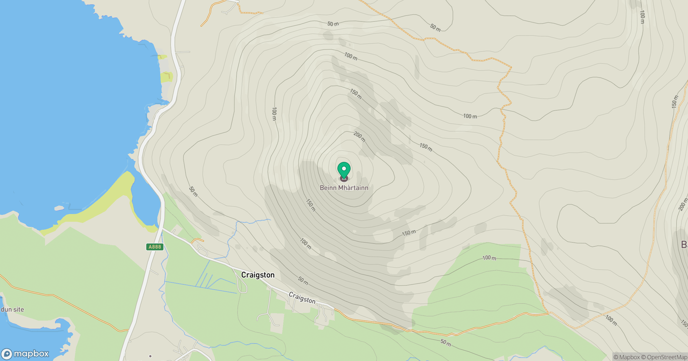
Grid reference: NF664020
View on OpenStreetMapOpens a map in a new tab, centred on the hill.
Hills within 30 km
Straight-line distance, not a walking route or confirmation of access.
No comments yet. Be the first.